Guyana, November 2023
The following images are a selection of the ~2000 images I captured during 10 days in Guyana. We spent the majority of our time visiting family around Georgetown and the northern coast, with a few expeditions inland.
Enjoy the gallery.
About Guyana
Guyana is a small country located on the north coast of South America
It has a small population of around 800K, clustered around the Atlantic Coast
About the same land area as Utah, but 1/4th the population
Generally, Guyanese people consider themselves Carribean vs. South American
Very heterogeneous population with roots in India, Africa, Europe, and China, as well as indigenous people
Many are descendents of indentured laborers
Guyanese Creole is the flavor of English spoken
Majority Christian, but Hindu and Islam represent large minorities
Little to no religious tension
Guyana means ‘land of many waters’
Our family flew to Guyana from New York’s JFK Airport on a direct 6hr flight to Cheddi Jagan International Airport (GEO). I expected the airport to be near the northern coast of Guyana, but it ended up being about an hour inland in an area called Timerhri. We were staying with family near the town of Georgetown so needed to make the hour drive up the busy East Bank road late that night. This was our first experience with Guyana’s aggressive drivers and poor road infrastructure.

departing JFK, iPhone shot
Once on the ground, it became very clear that Guyana is in the midst of a major housing boom. Homes are going up everywhere on reclaimed agriculture land likely fueled by an influx of wealth from the oil industry. It is shocking to see so many huge in-progress homes dotting the horizon for what is still quite a poor country.
On our first full day, we took one of the minibus taxis into the town of Georgetown to visit shops and landmarks. Street vendors were mainly selling produce and a curious selection of home remedies. A water bottle filled with mysterious brown liquid was ready to cure your every ailment.
Some Guyanese History
There are 9 main pre-colonial indigenous groups, some refer to themselves as ‘Amerindians’
Guyana was first colonized by the Dutch in 1581
The Dutch initially sought gold, then made a major push to adapt the land for sugar production
Much like parts of the Caribbean, the Atlantic slave trade allowed for these plantations to function
The majority of the populated land in Guyana is below sea level
The British seized control of the territory in 1814
Guyana finally gained its independence from Britain in 1966
My Dad was Born in 1960
A highly contentious relationship exist with Venezuela today stemming from disputed land on the western side of Guyana as well as offshore


Our first larger trip inland was to visit St. Cuthbert’s Mission. This is an Amerindian village located on the Mahaica River in the northern region of Guyana. A few hundred people live in this small village. My dad’s side of the family has Amerindian roots so we visited here to get a glimpse into this culture. Getting here took upwards of 4 hrs despite only being tens of miles from Georgetown because the majority of the road there was sandy and washboarded. Our small van was working hard to get us there, even losing the spare tire bracket due to the vibrations.
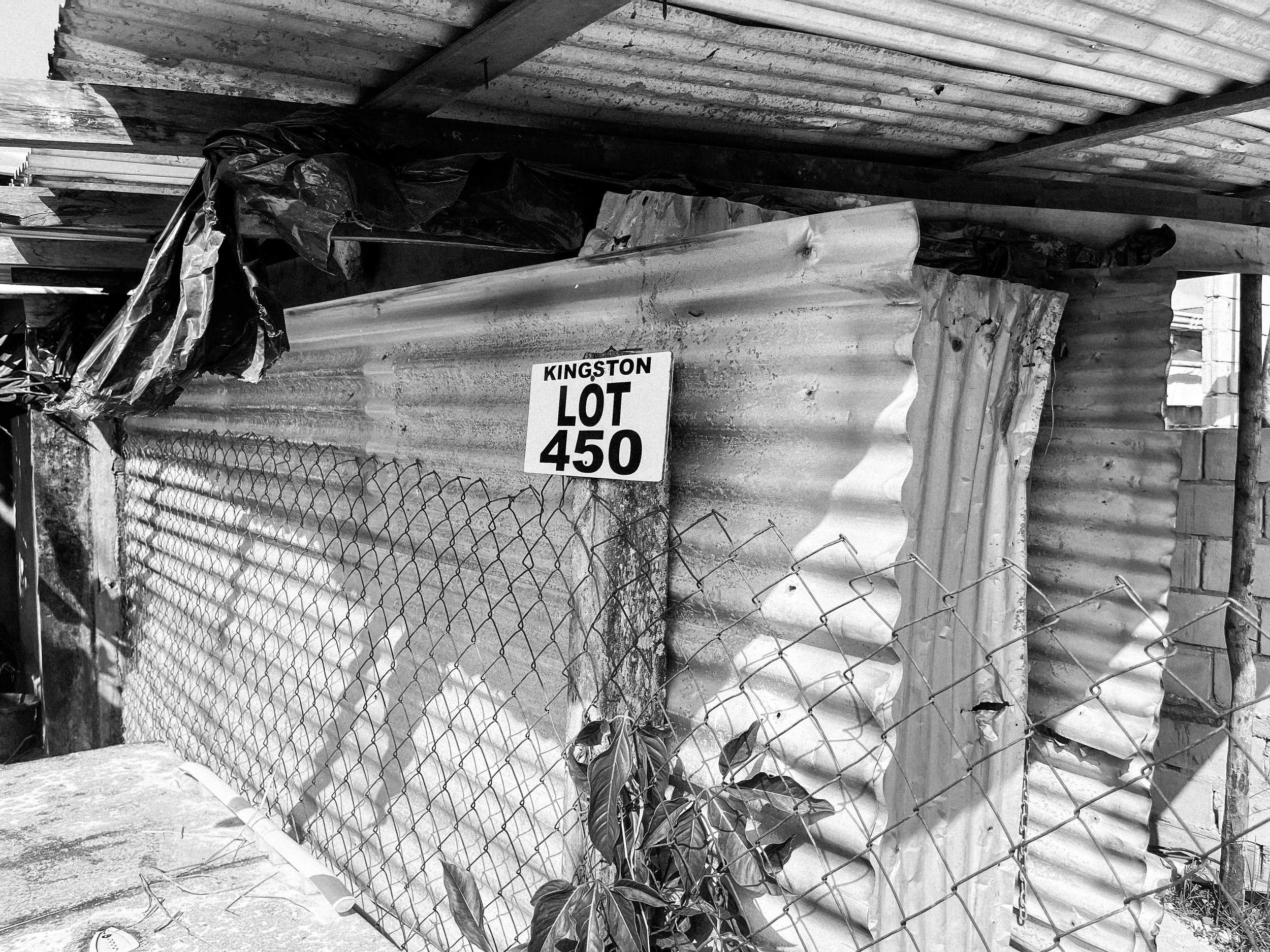
The next day we visited some more family, including a trip across the Demerara River bridge to see the build site for a new house for one of my Aunts. That bridge is a two lane floating steel bridge that is always at capacity and thankfully being replaced in the next few years.
We made sure to take pics of the Kingston sign on the lot ;)

3 dogs!

Guyanese construction methods

Later that same day, we drove over to what everyone called the ‘Sea Wall’. This imposing concrete structure was built by the Dutch in 1880 to fortify Georgetown from the Atlantic Ocean. Today, it also serves as a popular hangout spot. Georgetown sits about 7ft below sea level, so this, combined with the extensive canal and dyke system keep the land hospitable. Being near the Equator, Guyana does not deal with tropical storms, but has a dry and rainy season. Much of this particular section of the wall was adorned with bible verses, while the rest features ads for various businesses.
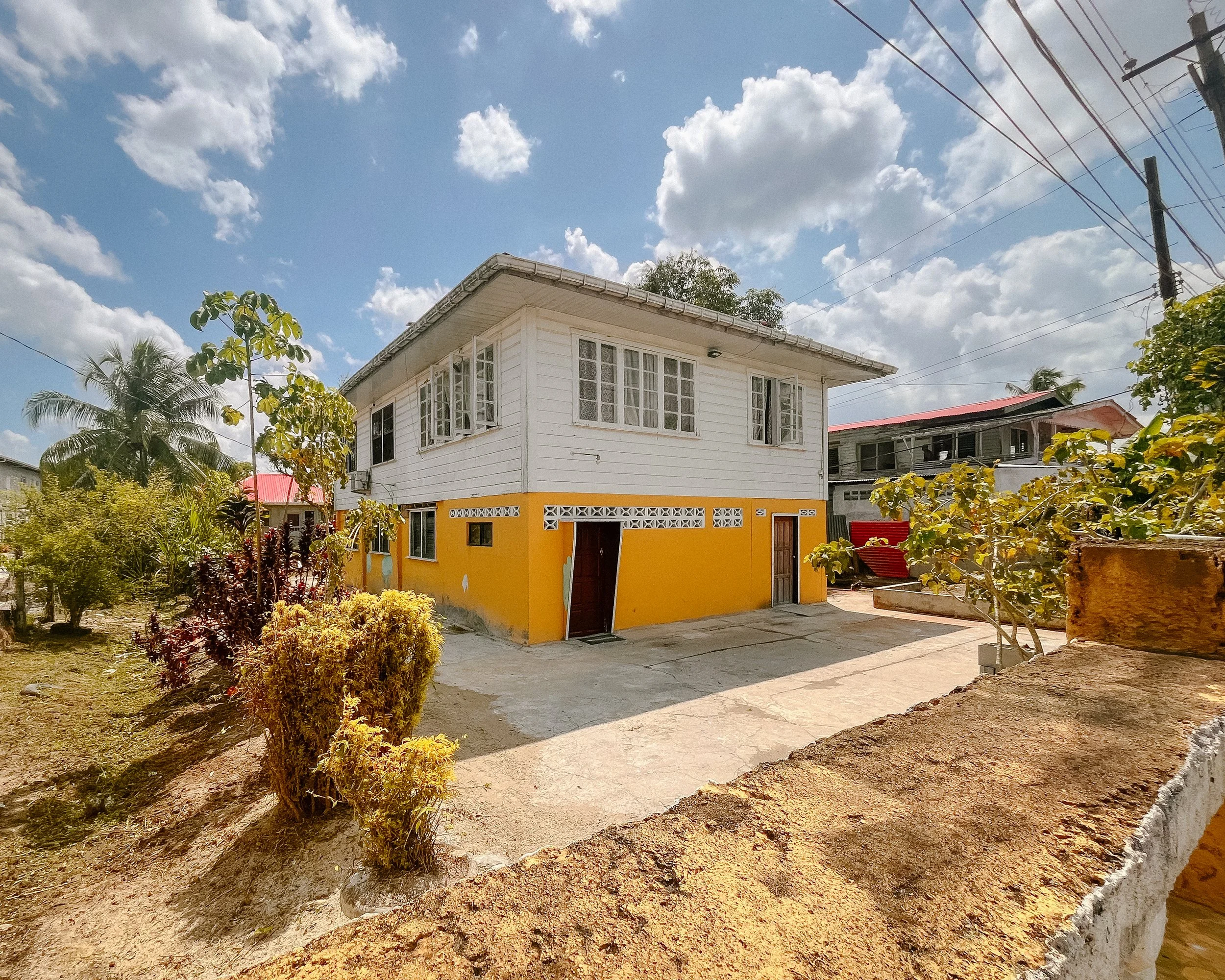

We also drove down to see my dad’s childhood home. I don’t recall ever seeing photos of this house growing up, so had developed a mental picture of the house that turned out to be quite different from reality. Once we were back in the US, my mom dug up a photo she tool of the same house 30 year prior when she visited last.
This place is called Splashmins Resort and is a manmade beach next to a slow moving river. This is a popular gathering spot on the weekends for picnics and parties. We spend the day with a bunch of family listening to the competing music being blasted from 4 different minibuses while consuming authentic Guyanese food. This place was also great for people watching…
On our 6th day in Guyana, we finally trekked beyond the north coast and headed inland to see Guyana’s famed waterfalls. We made the hour drive from our house to Ogle Airstrip which is east of Georgetown on the north coast. We had to wait a few hours at the airport for fog to clear at our destination. After it cleared, we took off on the 1hr flight to the airstrip at Kaieteur Falls National Park.
Soon after leaving Georgetown the ground quickly turned into a sea of trees. The rainforest extended to the horizon in every direction with a few small settlements dotted in clearings along the way. Finally, after about 50 minutes, we began to see some rising terrain, indicating that we were close to the destination. Finally, the pilot banked the plane hard left and did a few circles of the beautiful waterfall, before setting the plane down on the short landing strip in front of the park ranger station.

We left Kaieteur falls and took another 30 minute flight to Orinduik Falls, a cluster of waterfalls on the boarder with Brazil. Here I was able to capture a few long exposure shots of the various falls and make friends with some of the kids who were hanging around the airstrip.

one of the kids was chasing me trying to get me to eat some sort of beetle. no thx.
Conflict with Venezuela
Our last expedition in Guyana took us down the Essequibo River. This waterway also deliniates the disputed and undisputed regions of Guyana. The land west of the Essequibo is disputed with Venezeula dating back to the early 19th century.
In 1898 an international tribunal in Paris awarded Guayana Esequiba to British Guiana
This region, including territory offshore, is rich with oil, gold, diamonds, gas, and timber
Venezuela is not in good standing internationally with a looming presidential crisis being one of many current issues
Brazil’s Bolsonaro has taken a more aggressive stance towards the conflict, siding with Guyana
Tensions were flaring towards the end of 2023, but international diplomacy has thus far averted any armed confict.
Guyana’s very small army remains on high alert with most of its resources dedicated to protecting the very western border to Venezuela
The Guyanese military is ~5,000 people
The Venezuelan military is 15,000+ people
Any armed conflict would quickly turn into a regional conflict with Brazil, US and potentially Russian involvement
The GDP of Guyana grew sharply even during covid due to discovery of vast offshore oil reserves, likely accelerating this conflict
the exchange rate was about 200 Guyanese Dollars to 1 USD